 |
|
|||||||||||||||||||||||||||||||||||||||||||||||
| |
|
|
|
|
|
|
Webspace kindly donated by: |
|||||
| |
|||||
| |
|
|
|
|||||
 |
||||||||
|
||||||||
|
Useful Information |
||||||||
| |
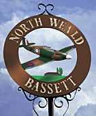
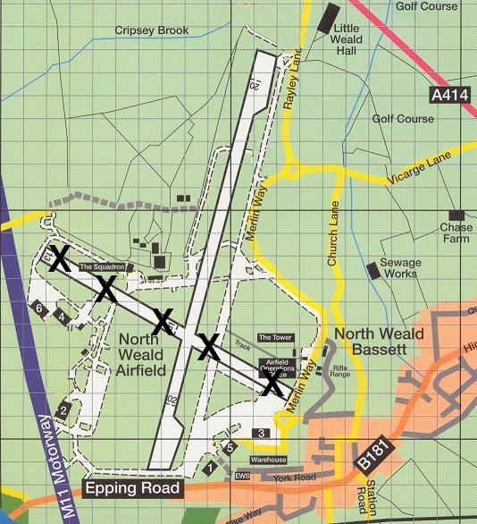
The following information is intended to help people visiting North Weald Airfield both by road and by air. North Weald Airfield is easily accessible by road. It is situated approx. 2 miles south east from Junction 7 (Harlow) of the M11 Motorway and is signposted from the motorway roundabout and also off the A414 Harlow - Chelmsford Road. You can find a map of the local area here: Click this link for road map To access the airfield, you will need to pass through the Epping Forest District Council's Airfield Operations Gatehouse entrance. A barrier is normally lowered and you will have to request access from the Council's gatehouse staff. However this is normally a straightforward formality if you are visiting one of the organisations or events based on the airfield. Please, however, observe their instructions. The airfield can get very busy with both aircraft and vehicles so please proceed with great caution once inside the perimeter fence and remain on the marked roadways. Do not enter any of the runways and observe the traffic light at the southern end of the airfield. Do not cross the ends of any runways when aircraft are taking-off or landing and always keep a good look-out. GIVE WAY TO AIRCRAFT AT ALL TIMES. For more information contact the EFDC Airfield Operations Office on: 01992 564200 IMPORTANT !!! https://www.eppingforestdc.gov.uk/leisure/northweald/information-for-pilots This information is only provided as a general
guide. Please refer to official documentation
for flight planning purposes, such as the UK
AIP, NOTAMs etc. Any information below is
unofficial and may become outdated without
notice. It should not be relied upon for
flight planning purposes. North Weald Airfield's co-ordinates are: N51°43.3
E000°09.3 Operating hours: 09:00 to 19:00 hrs. local (or sunset, whichever is the earliest). The airfield has 1 active runway: Airfield Layout
Although most of the motor
sport and other events held on the airfield
normally use the disused eastern side of the
airfield, it is also possible that Rwy 02/20 may
be closed on several days per year (mainly
Sundays) due to events on the runway, such
as motor sport, or the Wings & Wheels
Spectacular (model show). Please see our events
page for details. If in doubt, please
contact airfield operations in advance of your
visit. There is also a short grass strip occasionally in operation at the Northern end of 02/20, but you should always check in advance whether it is operational. Powered Circuits on 02/20 are generally flown to the West of the airfield. Gliders no longer operate at North Weald. Circuit height is 800' QFE / approx. 1200' QNH. IMPORTANT: Avoid Stansted's Class D airspace directly above North Weald, which begins at 1500' QNH, and also Stapleford Airfield's ATZ approx. 3 miles to the south. Over-flying North Weald Bassett village should be avoided whenever possible. Please also avoid over-flying St. Margaret's Hospital, at the eastern end of Epping Town. Be aware that many aircraft types, from gliders and microlights to military jets and warbird formations operate from the airfield, so extra caution and adequate spacing is required in the circuit. An aerial view of the airfield is available here: click this link to view aerial photo of North Weald. Click the following link for the official EFDC page with information for pilots planning to visit North Weald Airfield, including PPR requirements and scale of charges:https://www.eppingforestdc.gov.uk/leisure/northweald/information-for-pilots Other useful telephone numbers are: Control Tower: 01992 524740 EFDC Operations Office: 01992 564200 Further information on North Weald Airfield is also available from the excellent www.ukga.com website: http://www.ukga.com/aerodrome/view.cfm?aerodromeId=1338
|
|
[Home] [History] [Campaign] [Activities] [Register Support] |
| |
|
|
Please contact our Webmaster with questions or comments. |